Hobby Project — Not for Commercial Use

Open Source Airplane Tracking

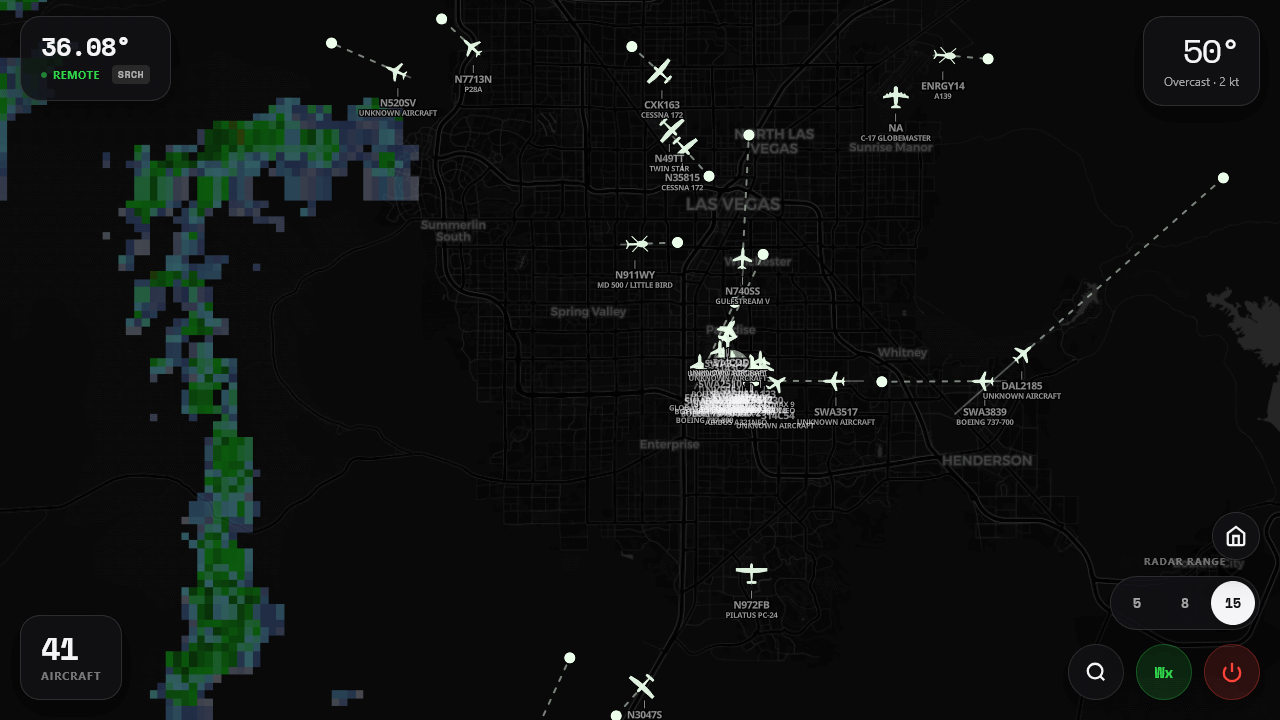
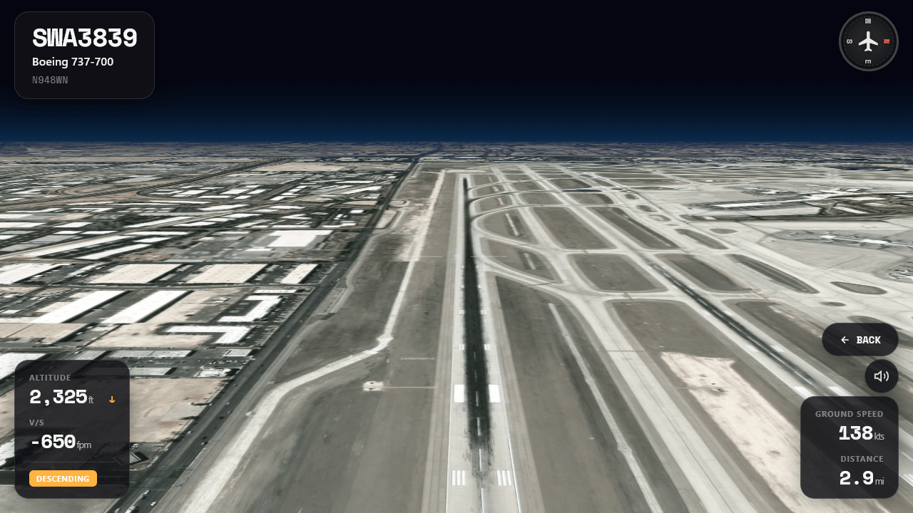
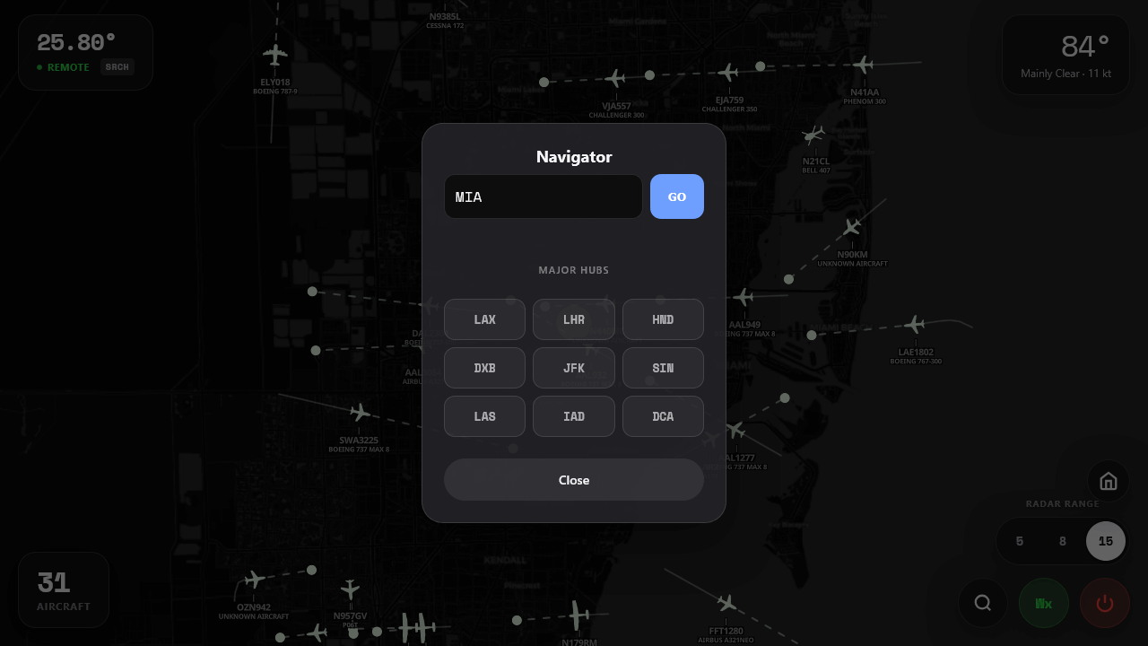
PlanePatrol© is a lightweight aircraft tracking engine built for plane spotters, aviation nerds, and hobby coders. It runs in your browser, pulls live aircraft data, and gives you cockpit mode, weather radar, and hotspot jumps. Clone it, extend it, or turn it into your own plane spotting app.

Single HTML file
~1800 lines of code
MIT License
PlanePatrol Interface
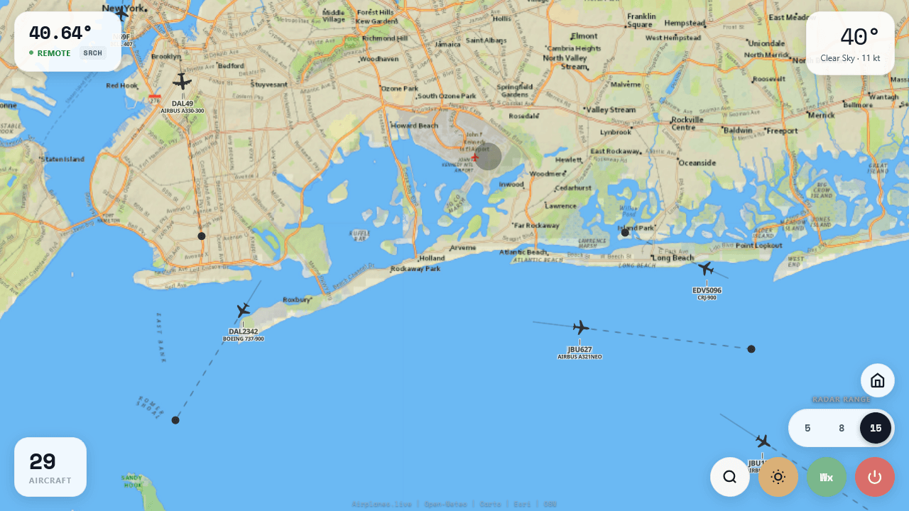
Near JFK International Airport

What You Get

Real-Time Tracking

Live aircraft positions updated every 3 seconds via community ADS-B network

Cockpit Mode

Immersive view with heading indicator, altitude, speed, and synthetic engine audio

Weather Radar

NEXRAD overlay showing precipitation intensity with adjustable opacity

Aircraft Trails

Historical path visualization with fade effect and predictive trajectory lines

Airport Search

Jump to any airport or callsign worldwide with geocoding and auto-complete

Three Map Styles

Toggle between dark mode, satellite, and terrain views

Hobby Project Disclaimer

This app uses free community APIs (airplanes.live, Iowa State weather radar) that aren't licensed for commercial use. It's meant for personal learning, tinkering, and plane spotting—not as a product or service. Please respect the data providers who make this possible.

See It In Action

Main radar view
Main radar view with aircraft trails, predictions, and weather overlay
cockpit view
Immersive cockpit tracking with flight data
Navigator
Search airports and callsigns worldwide

Three Ways to Use It

Try the demo instantly, or grab the code and make it your own.

1

Try the Demo

Click "Try Live Demo" to run it instantly in your browser. Allow location access to see aircraft near you.

2

Download the Code

Clone or download from GitHub. It's a single HTML file—open it locally or host it anywhere.

3

Make It Yours

Swap out colors, add features, connect different APIs. The code is clean and well-commented.

Demo Stack

Data providers who make this possible.

MapLibre GL
Open source map rendering
airplanes.live
Community ADS-B network
CARTO
Dark basemap tiles
Open-Meteo
Weather observations
Iowa State
NEXRAD radar tiles
OpenStreetMap
Geocoding via Nominatim
Web Audio API
Engine sound synthesis
ESRI
Satellite tiles

Ready to Track Some Planes?

Run the demo in your browser or grab the source and start hacking.

Try Live Demo View Source on GitHub